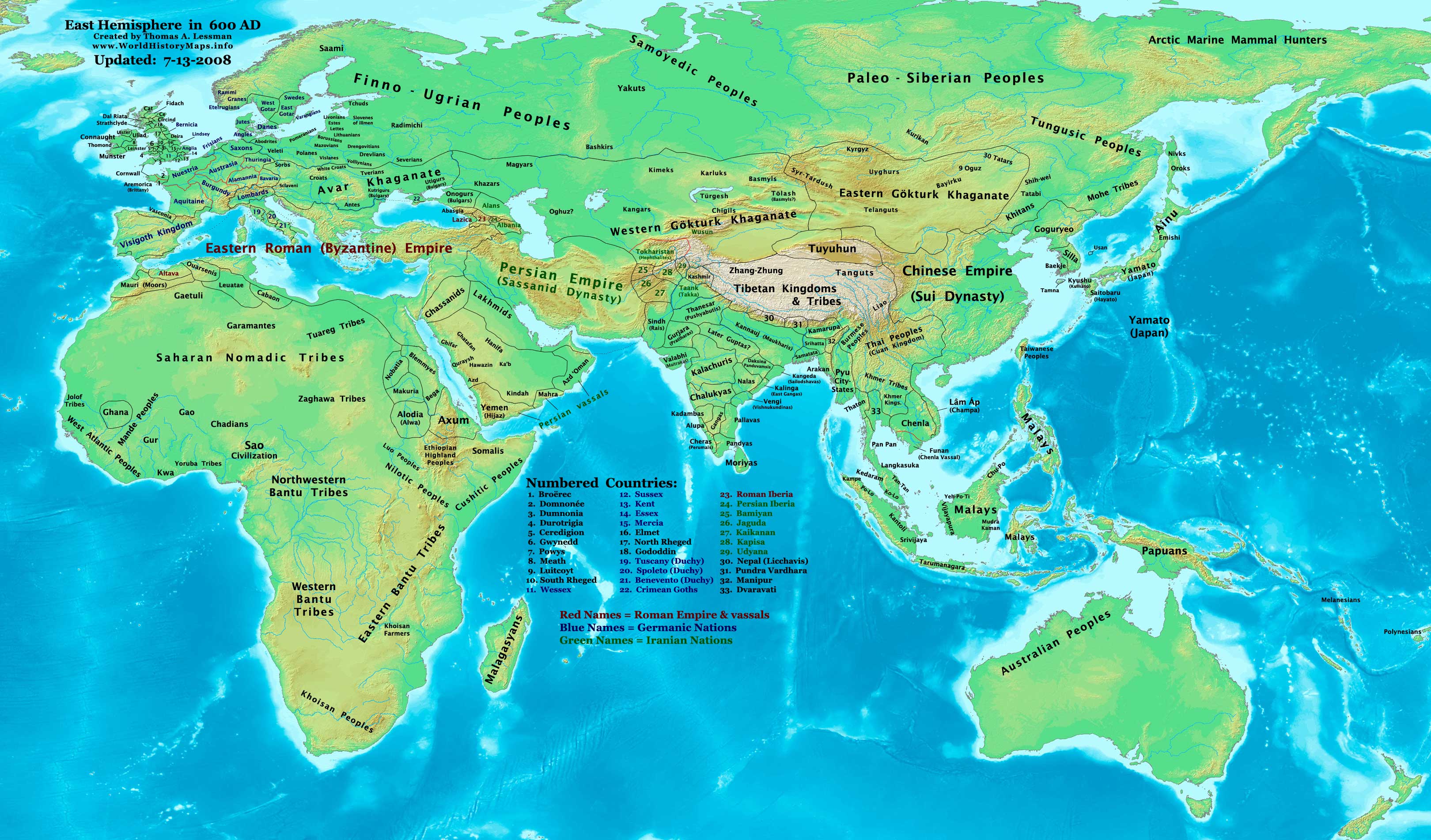
The Eastern Hemisphere in 600AD
We travel through Spain, Gaul, Italy, the Balkans, Anatolia, the East and Persia to uncover the geo-political situation in 600AD.
Period: 500-602
Map: The map shows the political distribution of states and nations around 600 AD.
(Author: Thomas Lessman, Source Website: www.WorldHistoryMaps.info.)
Download: Episode 39 – Neighbours and Provinces
RSS Feed: The History of Byzantium
If you want to send in feedback to the podcast:
– Either comment on this post.
– Or on the facebook page.
– Leave a review on Itunes.
– Follow me on Twitter.