
We explore who the Byzantines thought they were and whether they were right.
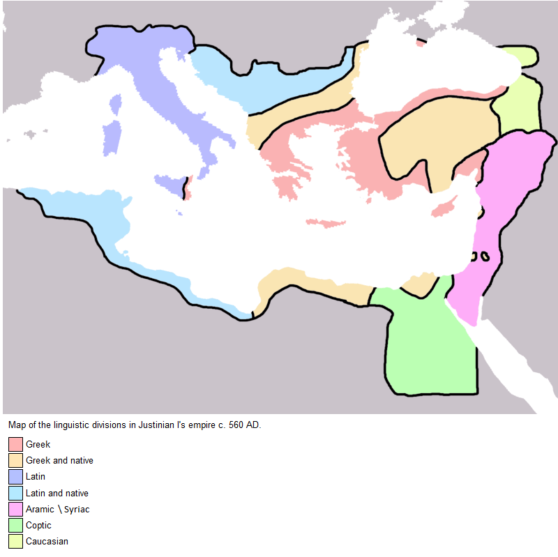
Linguistic map of the Byzantine Empire c565
Period: 500-602
Map: The map shows the theoretical linguistic distribution of people in the Byzantine Empire around 560 AD.
(The map comes from Wikipedia but the author admits he used a map from Cyril Mango’s book “Byzantium: the Empire of the New Rome” as his source. Source Website: http://en.wikipedia.org/wiki/File:Linguistic_Map_of_Justinian_I%27s_Empire_c._560.png I added the word Syriac after Aramaic. Syriac is derived from Aramaic and as it was the language of much writing in the area I wanted to make sure it was mentioned as part of the mix)
Download: Episode 41 – Who is a Byzantine?
RSS Feed: The History of Byzantium
If you want to send in feedback to the podcast:
– Either comment on this post.
– Or on the facebook page.
– Leave a review on Itunes.
– Follow me on Twitter.


